A little while ago I came across a local app on Facebook entitled “Glos Walks” which has entertained hubby and I in helping us to discover new walks in and around our great county of Gloucestershire.
Gloucestershire:
Covering 1024 sq miles this beautiful county lying in the South West of England was likely established in the tenth century, and expanded to approximately its current borders in the eleventh century.
It has three main landscape areas including a large part of the Cotswolds, associated with its honey coloured stone houses and cottages and designated areas of outstanding natural beauty. The Cotswolds take up a large portion of the east and south of the county.
These days, of course, it is also well known for its many famous residents including King Charles III, Princess Anne and her family, the Beckhams (just across the border), model Kate Moss, artist Damien Hirst, actor Richard E Grant and singer James Morrison to name but a few.
Also within it’s boundaries is the second landscape that is the Royal Forest of Dean, which takes up a large portion of the west of the county and which featured heavily in the filming of the Harry Potter film -Deathly Hallows. Probably not surprising when its author J K Rowling spent part of her childhood in this area.
The final landscape is the Severn Vale which stretches from historic Tewkesbury in the north of Gloucestershire, past the cathedral city of Gloucester and flows down towards the market towns and countryside of South Gloucestershire, following the winding path of the mighty River Severn. Along this scenic corridor, you will find castles, wetlands, picturesque villages and peaceful riverside walks.
The aforementioned app features over 150 walks so whether you are a resident of picturesque Gloucestershire or a temporary visitor there are plenty of new experiences and places to explore. All of the walks are circular which makes it so much easier to park up and then venture out to explore the countryside.
Joined by an old junior school friend and her husband who now live in The Netherlands we set out one sunny morning recently to find the source of the River Thames. This walk is under the heading of “Coates” on the app.
Coates:
The small village of Coates lies about 3 miles west of the Roman town of Cirencester. A large proportion of the houses and land within the village form part of the 15,500 acre Bathurst Estate. Earl Bathurst being based nearby at Cirencester Park.
Parking up in the village centre we hop out of the car and utilising the “yellow brick road” on the app set off on our walk in an anti clockwise direction.
It’s not long before we are passing the local 13th century church of St Matthews, sited right on the edge of the village and tucked away from immediate view. With its perpendicular tower, Norman doorway and well kept graveyard to the front I felt like it was thanking me for making it part of our walk today and was wishing us well on our journey today.

Making our way across some recently cut arable farmland we head towards the railway line.
The Golden Valley Railway Line:
This is the line that connects Swindon to Gloucester and Cheltenham Spa which opened between 1841-1845.
The “Golden Valley” is actually the section of the valley located between Chalford and Stroud where the River Frome flows, which the railway line follows for part of its route. However according to legend Queen Alexandra, wife of King Edward VII travelled along this route back in June 1909 and was struck by the sheer beauty of the countryside through which the train was travelling and coined the phrase “the Golden Valley” and it has stuck ever since.
If you are travelling from London and don’t wish to drive up to Gloucestershire, trains run regularly from London Paddington and you can experience the “Golden Valley” for yourself just as Queen Alexandra did.
Trains run regularly along this track in both directions and so crossing the line even at the designated place needs some care particularly with children and animals. We had to wait for a train to go past, blowing its horn as if to emphasise its domination and warning us of the danger.
On the opposite side we skirt Hailey Woods and join the Wysis Way. This is a 55 mile walking route which forms a link between the Offa’s Dyke Path and Thames Path, both national trails in the United Kingdom. Starting at Monmouth in Wales it winds its way east through the Forest of Dean to the top of May Hill (971ft), through Gloucester before turning south east through the beautiful villages of Painswick, Bisley and Oakridge Lynch and then following the Thames-Severn canal to Sapperton and eventually Kemble where it joins the Thames Path.
Who knew you could walk all the way from Monmouth in Wales to London?
Tunnel House Inn:

Arriving at the Tunnel House it is sad to see it shut and boarded up. It was well known back in my teenage years as a place to frequent for the odd drink or meal hidden away from the main road running from Cirencester to Stroud. Unfortunately it ceased trading in 2020 when the pub’s management were unable to reach an agreement with the landlords, The Bathurst Estate, which prevented them from continuing to trade.
It was actually originally built back in the 1780’s for the navvies working on the two mile long Sapperton tunnel on the Thames and Severn canal. There was a huge loss of life during the digging of the tunnel from 1788-90. The inn provided both lodgings for the navvies and also occasionally became a makeshift mortuary!
Turning left down the steps we join the Monarchs Way, a path known for its diverse scenery, which passes through various landscapes, including the Cotswolds, as well as many historical sites.
Stretching some 625-miles across England, Monarchs Way traces the escape route of King Charles II after his defeat at the Battle of Worcester in 1651. It is not a single, unbroken path but rather a network of existing footpaths and rights of way that roughly follow the historical route from Worcester, through Bristol and Yeovil, to Shoreham, West Sussex.
Sapperton Canal Tunnel:
Opened in 1789 this was the longest canal tunnel ever constructed in the United Kingdom at 2.17 miles in length, it is now the third longest. The first boat passed through the tunnel in April 1789 and the last commercial traffic to use the tunnel was in May 1911. Today the Sapperton Tunnel remains impassable with a number of significant roof falls and a complete blockage near the Sapperton end.
During the working life of the waterway, canal craft did not have engines. Instead, boats were pulled along the canal by horse, donkey or a man walking along the towpath. However there is no towpath within the tunnel so in order to get a boat through the tunnel, one or two men would lie on their backs on board the boat and ‘walk’ along the tunnel wall or roof. This process was known as ‘legging’. Another method used a pole to push the boat along, again using the tunnel wall or roof.

Active plans and restoration efforts to reconnect the 36 miles of the Thames and Severn Canal, specifically through the Cotswolds Canals Trust are in place. The restoration of Sapperton Tunnel is entirely feasible from an engineering standpoint. As might be expected though, this will be the most complex and expensive single element of the Thames and Severn Canal restoration.
Maybe one day we will be able to repeat this walk and actually see boats once again meandering along this wonderful old canal.
In the meantime our walk takes us alongside the canal sometimes ducking under or climbing over fallen trees that haven’t been removed in recent storms.
Coates Round House:
Alongside the canal path on our right we come across this wonderful historic building and immediately set about exploring inside and outside as best we can.
This is actually one of the five round houses on the Thames and Severn Canal, which were originally built as lengthsman’s cottages between 1791-2. One of the responsibilities of the lengthsman was keeping the towpath in good condition, ensuring it was clear of obstructions and suitable for horses to pull the boats. The Coates Round House featured as one of the three tallest of these roundhouses, the additional height concealing an inverted conical roof for collecting rainwater.
The ground floor was designed for stabling, and the upper floors, linked by an internal staircase, for living accommodation. This particular building was modernised and extended, and the ground-floor portion was then incorporated into the living accommodation.
The building is now unfortunately derelict, lacking floors or roof, but structurally it is in a reasonable condition.

All five original round houses on the Thames and Severn Canal have survived. Forming part of the Bathurst Estate this is the only one that is derelict.
Skew Bridge:
Leaving the roundhouse behind we walk underneath the railway bridge that carries the Golden Valley railway over the canal. Before the Ocean Railway Bridge was re-built and opened near Stonehouse in 2022 in association with the aforementioned Cotswold Canal Trust, this bridge was the only remaining live railway bridge on the Cotswold Canals. Notable for its intricate brickwork it’s worth a stop and a photo.

And finally the Source of the Thames:
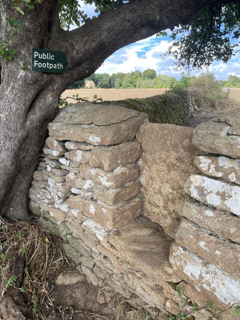
Whilst our circular walk from Coates doesn’t officially include walking to the source of the Thames it offers it as a slight diversion. Leaving the canal path behind we turn right and walk over green pastureland, keeping the boundary on our left and crossing over two fairly steep step stiles ( not great if you have a dog with you) plus one further stile.
It is during this section of our walk that we bump into a gentleman on his bike with his dog and in typical Cotswold fashion stop to pass the time of day. It transpires that his family own the land on which we stand and a polite conversation ensues where we learn more about the surrounding area and the Thames source.
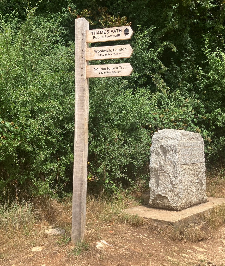
You can’t miss the famous source of the Thames, there is a clear upright stone marker accompanied by a pile of small stones in front, below which the spring head is located. Both of these were placed here by the Thames Conservators in the 19th century to indicate the official source of the River Thames.

While the area is considered the source, the springs themselves are often dry, as they were on our visit. Our farmer acquaintance had explained that the route to the stones that we had walked is, however, often very wet and can form a stream after heavy rainfall.

There may not have been any water present on our visit but we were joyful anyway to have actually stood where the Thames begins before it makes it way eastwards across Gloucestershire, Oxfordshire and on into London. The Thames Path also begins here and is clearly marked telling you it is 184 miles to walk to the Thames Barrier in London where the path ends!
Finishing the Circle:
We returned to the point where we had diverted off “our yellow path” and followed it the short distance back to Coates and back to our car.
If you are in need of refreshments, The Thames Head Inn is only a five minute drive from here on the main Tetbury to Cirencester road. We haven’t been there but Tripadvisor gives it 4.5 stars from over 600 reviews if you wish to take a look.
Gloucestershire offers some wonderful opportunities for you to take a stroll, a walk or even a hike in some beautiful countryside and the Glos Walks app really helps with this. You can get a real insight to the distance, topography and sites before you embark on your chosen walk and they also recommend some “watering holes” for refreshments.
NB:
This is my fourteenth post in a series I have written about The Cotswolds. Why not check out the others and share with me any that you would recommend for us.
