Our next adventure in Antigua took us to Betty’s Hope, Devils Bridge and then lunch and an afternoon at Half Moon Bay.
It gave us a good introduction into the broader island, the people who live here, the tourist infrastructure and its association with the overall economy.
Betty’s Hope
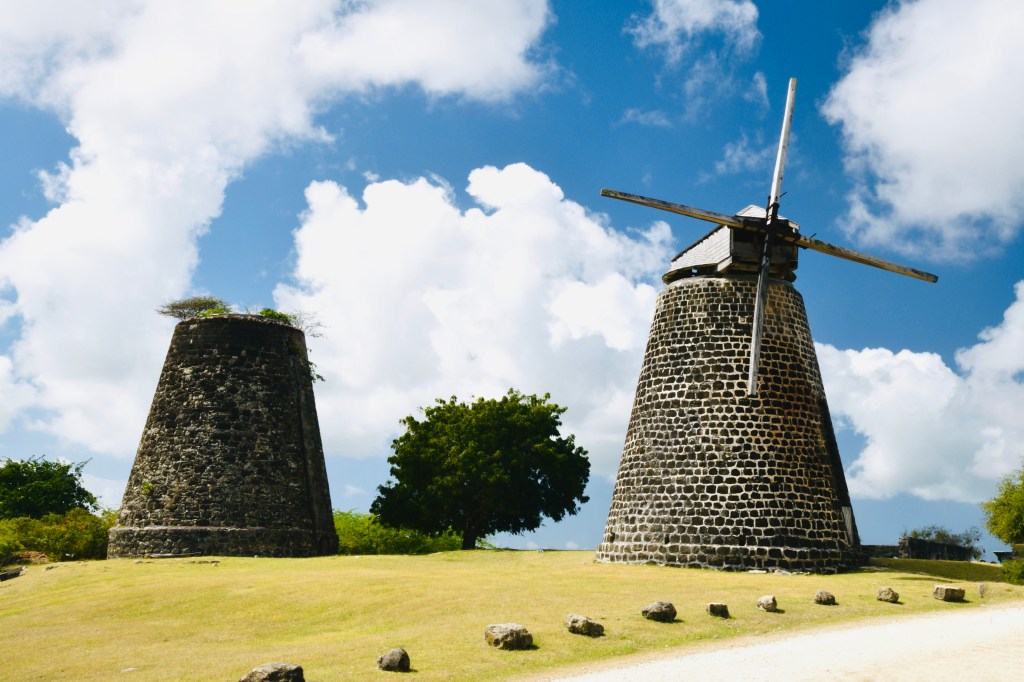
Betty’s Hope is a historic sugar plantation located in the eastern part of the island just south of the village of Pares. It was 12 miles from our accommodation, east of St Johns, with a travel time of about 35 minutes.
We actually managed to drive past the entrance as the signage isn’t that big and the turning off to our right was basically a dirt track rather than an actual road.
The plantation occupies a low limestone hill in a rural agricultural landscape, reflecting the type of terrain historically used for sugar cultivation on the island.
Founded in the 1650s, Betty’s Hope was primarily owned by the Codrington family from 1674 until 1944 and became one of the earliest and most productive sugar plantations in Antigua, helping to establish the island’s economy around sugar production during the British colonial period. Its operation depended on the forced labour of enslaved Africans, who worked the cane fields and the industrial processing buildings where sugar and rum were produced. The remains of the plantation complex—such as the windmills, boiling house, still house, and cisterns—illustrate the scale and organisation of the sugar industry that dominated the Caribbean during the seventeenth and eighteenth centuries.
It is very much an open-air museum and although it is managed by the Museum of Antigua and Barbuda, there is little evidence of any actual custodians. The guides we saw there were leading groups of tourists brought from the cruise ships that were in that day.
It is very much a self led experience with a small visitor centre with interpretive displays explaining both the sugar-making process and the lives of enslaved workers on the estate. You can explore the restored twin windmills, ruins of processing buildings, and surrounding landscape at your own pace.
The site typically operates during weekday daytime hours (roughly 9:00 am–3:00 pm), and entry is free. There is a collection box within the museum for donations of around 5 XCD per person to support maintenance. Basic parking is available on site but there are no cafés or restaurants on the grounds, so you are probably only likely to be there about 1-2 hours depending on how much you wish to read about the site and how many photographs you wish to take.
Whilst Betty’s Hope is presented to visitors as both a heritage landmark of Antigua’s sugar economy and a memorial landscape reflecting the island’s history of slavery, it was also, for us, an introduction into the dichotomy that surrounds the tourist trade on the island. This is something that I may well write about later.
Devils Bridge
Just 5 miles East of Betty’s Hope lies Devil’s Bridge. Prepare yourself, though, for a 15 minute drive where the last mile or so is again very much a dirt track!
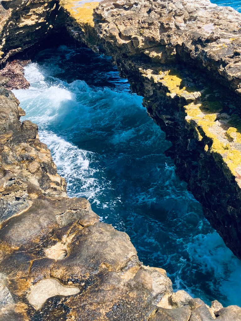
Devil’s Bridge, part of Devil’s Bridge National Park, established in 2008, is both a geological feature and cultural landmark. It is a natural rock arch located on the Atlantic coast of Antigua, where strong waves crash against the cliffs. It is one of the most famous natural landmarks on the island because of its dramatic coastal scenery and unique geological formation.
The bridge, itself, is a naturally formed limestone arch created by long-term coastal erosion (Wow! my geography A’Level came in handy!) and its unusual shape resembles a bridge stretching over the ocean, making it visually striking and popular for photography. As a result be prepared to wait to get a photograph without anyone standing on it!
Erosion continues today and over time, cracks in the limestone may grow, meaning the arch could eventually collapse as part of the natural coastal cycle.
Local legends claim that enslaved Africans jumped from the cliffs to escape slavery, contributing to the name “Devil’s Bridge”. Whilst archaeological evidence also shows prehistoric Amerindian settlements lived nearby, suggesting the area had earlier cultural importance.
It’s worth taking a short walk around the surrounding coastline to see the powerful waves that create a spectacular display of sea spray and crashing surf whilst the rocks contain natural blowholes. When waves enter underground cavities, water and air are forced upward, creating dramatic eruptions of water.
We probably spent about 30 minutes here but you can walk around the wider area of the limestone coastline.
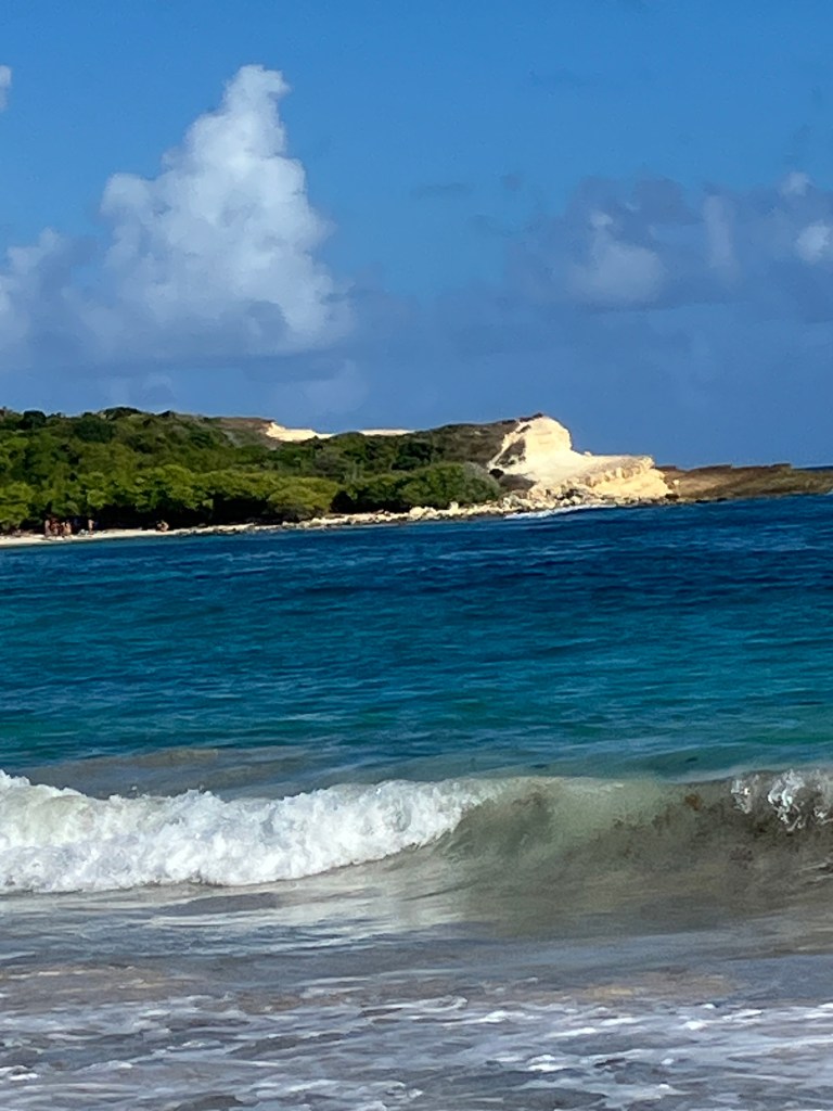
Half Moon Bay
11 miles further south but still on the east coast is Half Moon Bay with spectacular views on the road down into it. Take care on this road as we came across several herds of goats just meandering along the centre of the road.
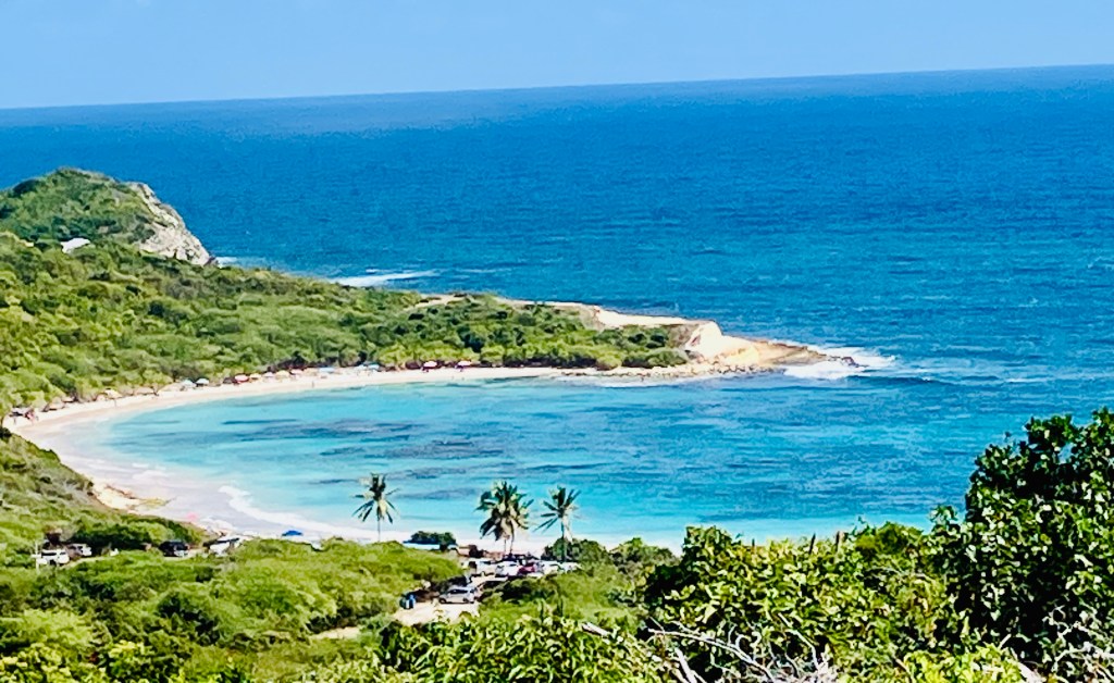
Half Moon Bay is one of the most beautiful and famous beaches on the island of Antigua. It
gets its name from its distinctive crescent (half-moon) shape. The beach curves around a wide bay with soft white-to-pink sand and bright turquoise water, creating a classic tropical landscape.
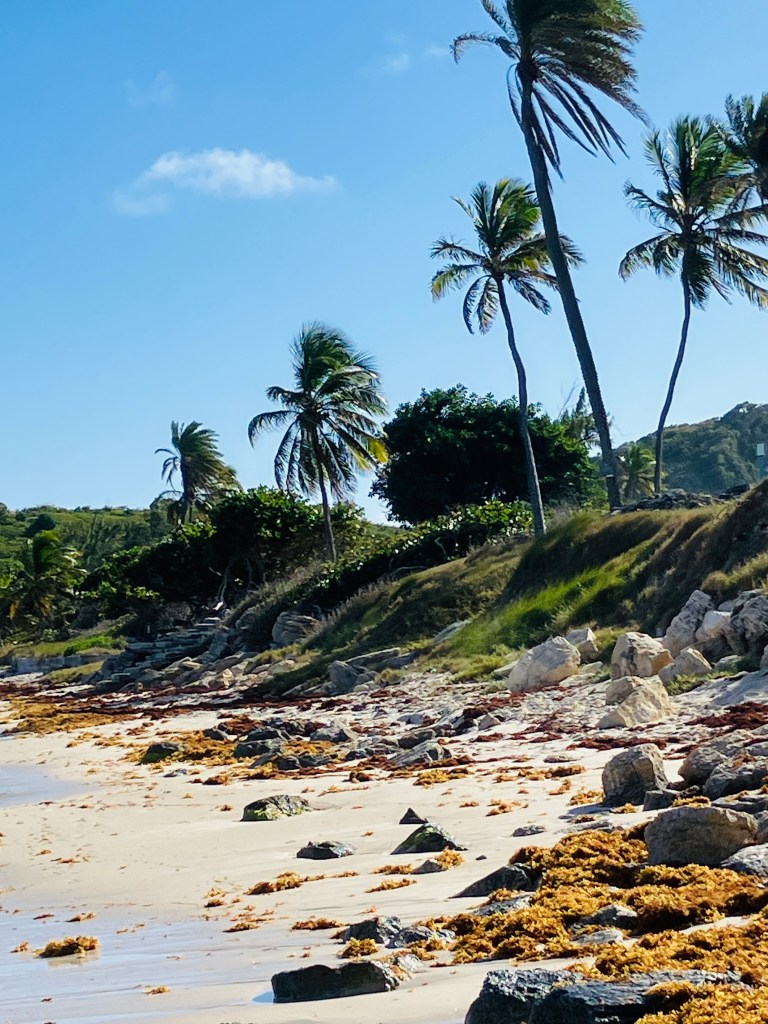
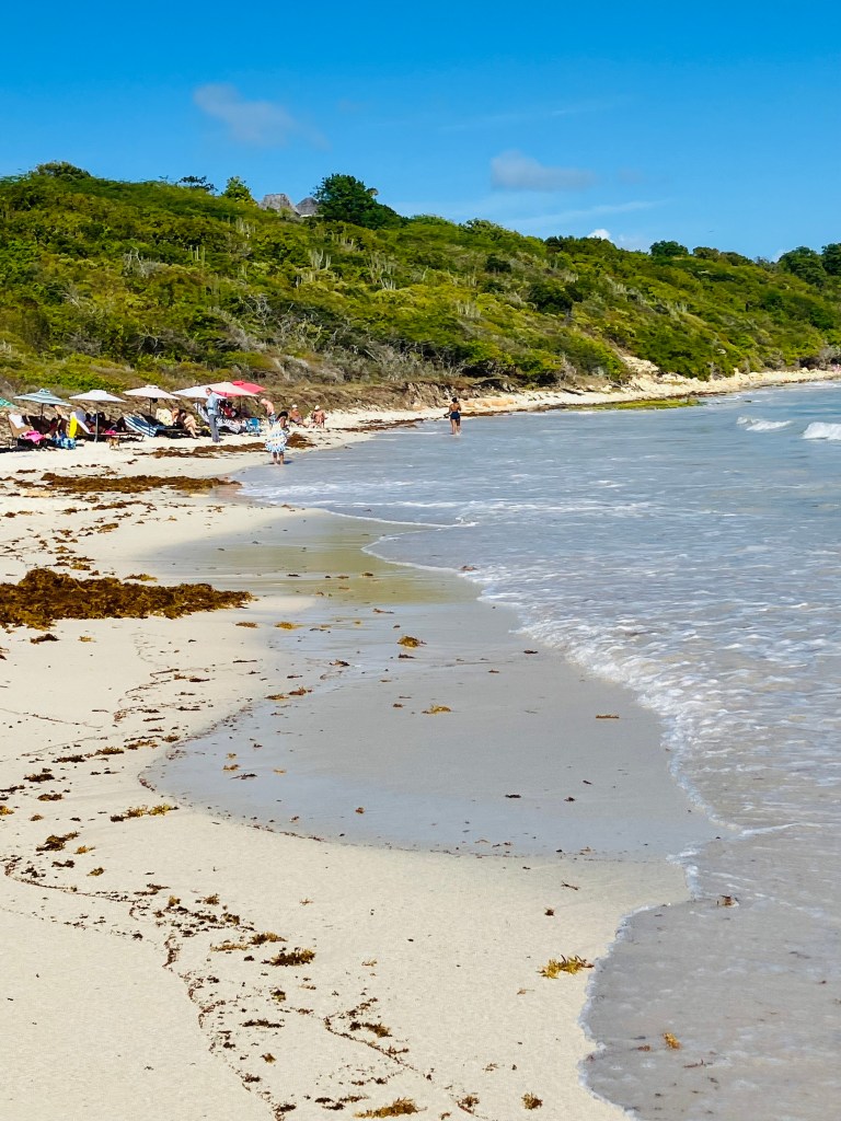
Parking is basically where the road down into the bay ends with a short footpath leading you past the Beach Bum Bar and Cafe. With almost a mile of beach there is plenty of chose in terms of where to sit and enjoy this spectacular scenery.
We made the mistake, however, of sitting fairly close to where the path ends. We discovered later, from our friendly Canadian neighbours, that the waves were not as big further around the bay and, therefore, snorkelling ( which with churned up sand where we were wasn’t possible) was quite good in the calmer waters.
Friendly locals operate the rental of chairs and umbrellas but they don’t charge you until you leave and its fairly normal for them to start closing down about 4.30 -5.00 p.m.
Compared with many Caribbean resort beaches, Half Moon Bay feels peaceful, uncrowded and more natural. Maybe because it is surrounded by vegetation and open coastline, which makes it feel less developed, calmer and definitely tranquil.
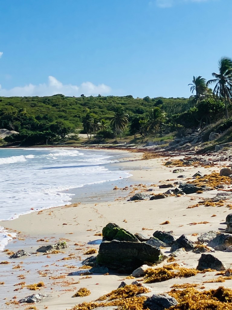
Whilst we were happy to relax, read and swim in the clear Caribbean water you could bring a picnic, make the most of the steady ocean breeze to fly kites with children and also take a leisurely stroll right around the bay to the point you can see below in the centre picture where hikers were scrambling up the rock.
Photography enthusiasts may also enjoy the natural scenery.
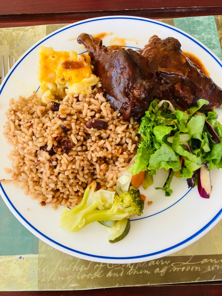
Today’s Food:
We stopped for lunch before we set ourselves up on Half Moon Bay.
We could have eaten at the Beach Bum Bar and Cafe and it certainly seemed to be popular, however as you come down into the bay, on the final stretch of road there is a local haunt on your lefthand side called “Smiling Harry’s Thirst Quencher” which has a 4.5 on Tripadvisor.
Unfortunately “Smiling Harry” ,who is an actual person, wasn’t there when we visited but despite this we had a fantastic lunch.
It is a real beachside gem that offers delicious and authentic island food accompanied by friendly hospitality. The gentleman serving, seemed to be fairly new and was probably more accustomed to the locals who frequent this authentic Antiguan eatery.
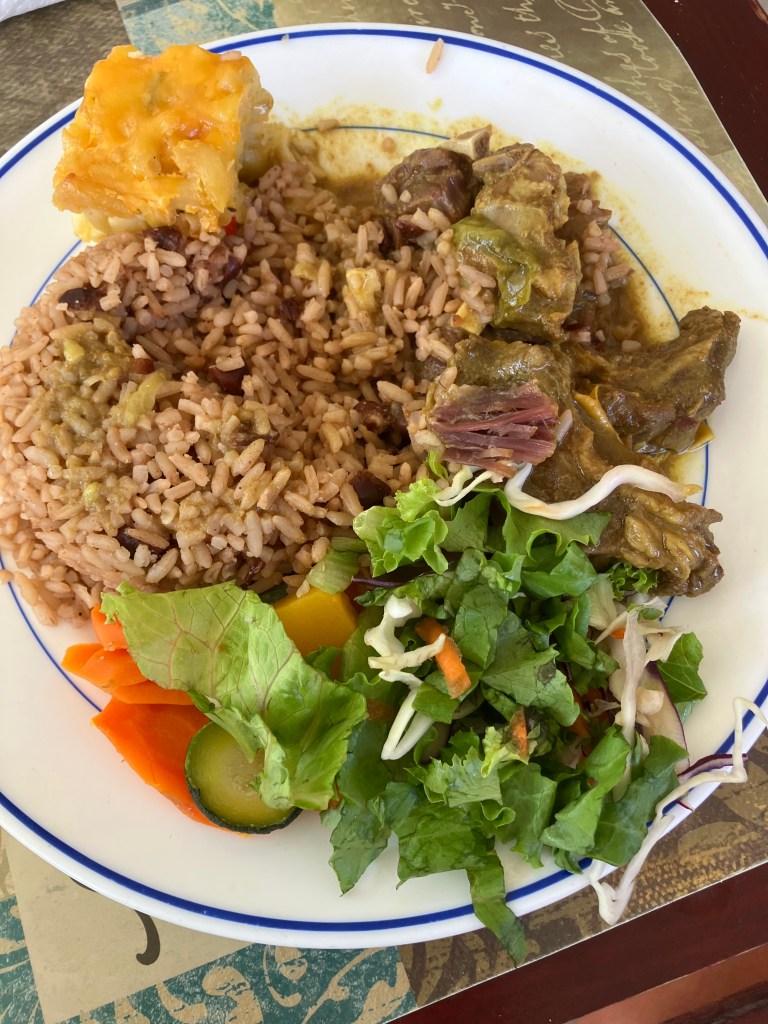
They offer a variety of tasty and generously portioned dishes at reasonable prices created by a very good local cook. They definitely pride themselves on their food serving up mouthwatering options like curry goat and garlic shrimp accompanied by rice, salad and Mac pie.
We chose the curry goat and baked chicken, both of which were yummy!
Final thoughts……
The East coast of Antigua has much to offer from history to geology and a fantastic Caribbean beach. Have I inspired you to perhaps include Antigua in your Caribbean itinerary?
Would you have eaten at the local restaurant like we did or would the Beach Bar been more your thing?
Let me know your thoughts and comments ……………
