As we travelled alone across the flat farmlands of Illinois often alongside field after field of unripe corn, our thoughts often swayed to those who had travelled this road before us.
Route 66 was the first highway of its kind. Designed in 1926 this 2,448 mile road was the first trans-continental, year- round highway. It connected urban and rural America from Chicago to Los Angeles, crossing eight states and three time zones. Most small towns had no prior access to a major national thoroughfare.
People wanted to pursue the American dream and saw the idea of travelling west along Route 66 as an opportunity to turn this into reality. Like the settlers of the mid 1800’s before them this was their chance to make a better life for themselves.
We are following in their footsteps only life has progressed since then. We don’t need maps when everything can now be found written in a guidebook, on line or on an app. I bought the EZ66 book written by Jerry McClanahan, which I have to say in this world of sat navs and Apple/Google maps seemed somewhat archaic but I was prepared to give it a go. I did, however, whilst in Chicago, do a bit more research and found a Route 66 navigation app which has already become invaluable.
That being said as we neared the state line between Illinois and Missouri we found the app telling us to double back and take a fairly narrow road towards a dead end two miles ahead. There were moments where we nearly stopped and turned around but in the end we had faith that it knew better than us and following the road we entered Chouteau Island, eventually finding ourselves in a car park with about half a dozen other vehicles.
Leaving the car locked and secure we headed towards a barrier which was there to stop vehicles from entering. ‘The Old Chain of Rocks Bridge”, as we had now discovered it was called, was only open to pedestrians and pushbikes but had once been the Gateway to the West. A means for motorists to cross the state line from Illinois to Missouri, one state down and seven more to go!
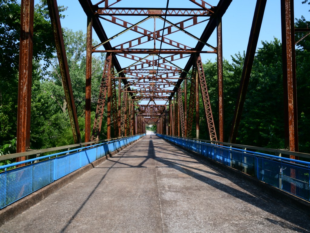
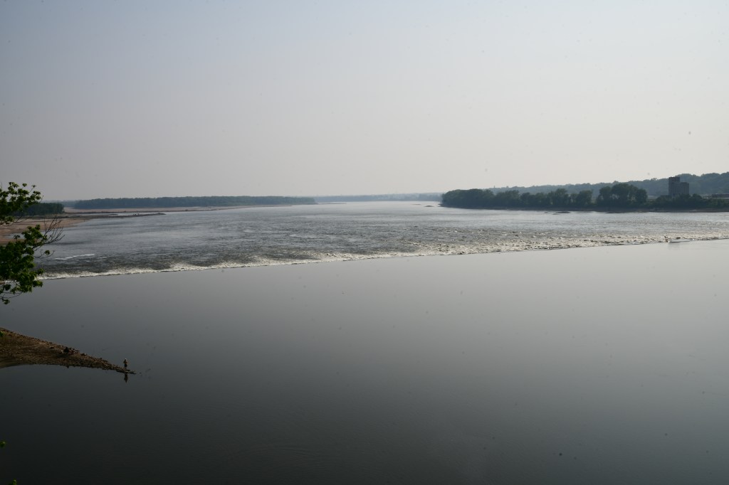
We were definitely a bit tentative, not really knowing what to expect but could see people in the distance walking ahead and so off we ventured. At first we walk between woods of elm trees with the red iron tresses of the bridge towering over us. The sounds of nature are all around and then suddenly there is a faint roaring sound which gets louder the further onto the bridge we walk. It sounds like you are approaching Niagara Falls and then the woodland gives way to the most spectacular sight. This is the Mississippi River in all its glory. You just don’t expect to see this, it’s stunning, I am in awe!
To the left of us is a weir where the lovely still water suddenly turns into a raging torrent and this stretches right across from one side to the other. Beyond the weir where the water becomes still again there is actually a small beach and I can see cars in a carpark. I guess people come here to have a day out and spend the day on the beach. Just in front of me on the headland between the weir and the beach is a lonely fisherman standing on a small promontory ( you can just see him on the mid left of my picture) and no doubt hoping to bring home his supper.
The original roadway is still evident. You can see both lanes. The total width of the bridge is 24 feet and I learnt later that this is the reason the bridge was closed to motorised transport back in February 1970, after a second bridge was built to the north which could carry modern transportation.
Standing on the bridge looking down at the Mississippi, imagining the excitement of those motorists as they drove onto the bridge and crossed over to the state of Missouri is one of those moments in life that I’ll never forget.
Can you imagine how it felt to pack up your car, load your family and what little belongings you could fit in? You would be leaving your home behind and travelling potentially 2400 miles west to California with no knowledge of what lay ahead but with that fixation of a dream of a better life keeping you going. Back in the 1950’s when Route 66 was most popular, this journey would have taken more than the 2-3 weeks recommended for today’s traveller.
The last surprise is still to come. As you approach what your eye believes is the end of the bridge you realise it’s not the end. Instead the road turns a near 25 degree angle and bends to the right. It’s then you see the final end of the bridge on the other side of the river. The bridge in total stretches a full mile across the Mississippi. In that moment my mind goes back even further to the 1800’s and questions how those early settlers with their wagons and horses crossed over this mighty river? How incredibly brave they were. I wonder if we would have been that brave?

As you reach the Missouri side of the bridge you can look over to your left and see the arch of St Louis which is about twenty miles away. The sky isn’t completely clear but I imagine on a better day the view is spectacular.
When I researched the bridge a little later sat on my bed in my bed and breakfast in St Louis I discovered that they used to charge a toll for motorists to cross the bridge. The anticipation as the cars queued up waiting to drive onto the bridge having passed over their cash must have been immense.
Route 66 has given us our first surprise, I wonder how many will follow?


I had not realised that you were travelling route 66 bit of a classic! Currently the UK is rather warmer temperatures up to near 30° C. I don’t know how parts of the world exist when it’s nothing 50°C. Nothing really remarkable here. I’ve been at home following a cataract operation, which is rather limited what I can do just beginning to get things sorted.
Off to the Royal Academy summer exhibition on Thursday, which is about the limit of my aspirations.
LikeLike
Thank you for your comment Nigel and more importantly reading my posts x
LikeLike